


| Brand | Drone Type | Quadcopter | Camera Resolution | 20MP | Survey Speed | 30 km/h | Operating Range | 5 km |
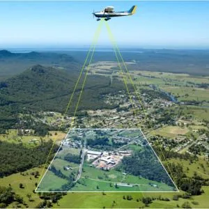
Soar to new heights with ARD Geographics' Drone Aerial Surveys in Ajman, UAE! Our cutting-edge Drone Surveyors capture a bird's-eye view, unveiling hidden details for precise surveys. Navigate landscapes with ease as our technology maps and models with unparalleled accuracy. From construction sites to vast terrains, ARD Geographics transforms perspectives. Elevate your surveys with innovation – choose Drone Aerial Surveys by ARD Geographics, where precision meets the sky. Discover a new dimension in surveying.
|
Nature of Business Surveying Services |
Year of Establishment 2021 |
Website https://www.ardglobal.com/ |
Working Days Tuesday - Monday 09:00 17:00 |
Trade License 15444 |
Service Area Ajman, United Arab Emirates |
Certified Certified by TradersFind |
ARD Geographics was founded in 2001 and embarked on a journey in geomatics engineering, founding a company with a vision to provide exceptional land survey services in the UAE and the Middle East. We are a prominent leader in professional services across the United Arab Emirates. We are committed to its core mission of assisting with land studies, pledge honesty, timely project completion, and cost-effectiveness for our clients. Explore our offerings at ARD Geographics, with our expert Route Surveyors, Land Surveyors, and Marine Surveyors, all falling under the comprehensive category of Surveyors. We are dedicated to delivering quality services that align with our client's needs and expectations.